The auction has ended and I’ve been auctioned off by the group (Point Reyes National Seashore Association -PRNSA) that is responsible for the restoration of the wetlands pictured below, and for making them a part of that same National Seashore. I will be leading a kayak photography tour through them for the lucky bid winner.
The Giacomini Wetlands are a magical place. They are at the very southern end of Tomales Bay (a beautiful protected bay about an hour north of San Francisco), and for over 50 years they had been blocked off from the tidal influence of the bay with a series of levies and dams and turned into cow pasture. It was part of a working dairy with a milking barn that was right next to the local fire station and three blocks from the small downtown and Highway 1. It gave the place a rural and bucolic feel, and when the wind was wrong a little too country of a stench. (You can’t be milking a couple hundred cows a day without creating a bit of fertilizer.)
Around the start of the new millennium PRNSA was able to help coordinate the acquisition of these 550+ acres of former bay land, and to help turn them into park property as part of the Point Reyes National Seashore. This land was grazed for a few years as planning began on how to restore these lands both physically and financially.
You see, there was no way real way to restore these lands to exactly what they had been before they were turned into pasture. In the 75 years before that, in which europeans had settled and begun farming the land, that southern end of the bay had silted in a bit and gone from shallow bay to mudflat (which is what made it somewhat practical to become pastureland). There were no surveys of original depths of the water or heights of land. There was no “original” to really be returned to. In a way the restoration project became creation project instead of a “re”creation, since they had to invent their own “ideal.”
They did use old photographs, both aerial and otherwise, to place the tidal sloughs where they had once beens. They tried to remove as much of the soils as they could that had been added on with the cows, trucking the dirt to other locations in the park that had served as quarries before they had become parkland and filling those quarries in to their original land shapes. A massive amount of dirt removal and transportation took place.

The main tidal slough, dug out to follow its old bed as seen in old photographs
It was during this restoration process, somewhat towards the end of it, that I became at least slightly involved. After talking with the park I was granted access while the machines were in there transforming the landscape, and began to document the project. It was impressive to watch the progress and the scope of what was going on. The area was also rich in wildlife and birdlife and I wanted to see what changes would come to the area when the sea once again regained its influence.

This cow skull I saw out there seemed rather symbolic of the change from pasture to wetland that was about to take place
All of the work began to close in on October 25, 2008- the date when they would breach the levies for the last time and allow the tidal waters of the bay back into these lands (They couldn’t breach the levies until the earth removal was complete, or else the machines would have to work in the water and mud at low tides.) I was able to be there on that day to take photographs for the local paper. It was a beautiful thing to see, even if the instrument of the final breach was an eye jerking orange…

The bay waters surge towards me as I stand down in the slough, photographing the historic breaching of the levies
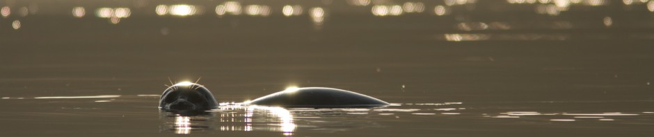
Now the only way to truly get into these wetlands is by kayak. They are a tidal mass, creating critical habitat for several endangered species. They also provide a home for a plethora of life, including various shorebirds that can be seen by the thousands. A wintering ground for migrant ducks (which can also be seen by the thousands). They are a transitioning ground for young salmon on their way to the salty ocean as they leave the streams they were born in. Their creation has also eased the flooding of many homes and of local roads in the wintertime. These wetlands have been a good thing in so many ways that it is hard to list them all. They are even a perfect place for a little kayak photography.


Nice !
Thanks. It’s a beautiful place